"\\\"(其後字詞)無法查詢, 因為 聯合目錄 的查詢上限是256個字。
"1;&"(其後字詞)無法查詢, 因為 聯合目錄 的查詢上限是256個字。
符合的藏品
共找到 25 筆符合的資料
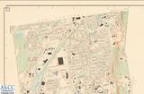
地圖名稱:GEODETIC AND TOPOGRAP...
註:1.民國96年8月20日建檔. 2.有等高線. 地圖名稱:GEODETIC AND TOPOGRAPHICAL SURVEY MAP OF NEWINGTON 靜態圖像 數位化執行單位:中央研究院.....more
- 1/25
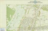
地圖名稱:THE METROPOLITAN DIST...
AND TOPOGRAPHICAL SURVEY 靜態圖像 數位化執行單位:中央研究院人文社會科學研究中心 數位化執行單位:中央研究院人文社會科學研究中心 .....more
- 2/25

楊家駱與新方志--以《北碚九志》...
新方志 北碚九志 城固縣志 遵義新志 New topographical records Pai-pei nine topographical records Topographical.....more
- 3/25
Transient Topographical Disori...
Topographical disorientation Visual agnosia Stroke Cerebral ischemic attack 短暫性區域失認症 腦缺血 國家圖書館.....more
- 4/25
臺灣東南地區海陸地形特徵及其構...
弧形山脊 地形線型 地形濾波 板塊運動 Hinge-arced mountain Topographical lineation Topographical filter Plate motion.....more
- 5/25
Transient Partial Amnesia Pres...
as Topographical Disorientation 臺灣期刊論文索引系統 來源期刊:Acta Neurologica Taiwanica 卷期:11:3 民91.09 頁次:頁155-157 A020267.....more
- 6/25
Brain Mapping of Visual Evoked...
--Topographical and Functional Components 臺灣期刊論文索引系統 來源期刊:Acta Neurologica Taiwanica 卷期:14:4 民94.12 頁次:頁.....more
- 7/25
Thalamic Hemorrhage: A Clinico...
Chia,Lie-gan Thalamic Hemorrhage: A Clinico-topographical Analysis of 114 Cases 臺灣期刊論文索引系統 來源期刊:Acta.....more
- 8/25
認路障礙的行為神經學觀
找路行為 認路 地域失定向 失智 認知地圖 海馬迴 腦傷 Way finding Navigation Topographical disorientation Dementia Cognitive.....more
- 9/25
經建版地形圖和像片基本圖在濱線...
濱線繪製 濱線指標 陸圖 經建版地形圖 像片基本圖 Shoreline mapping Shoreline indicator Terrestrial map Topographical map.....more
- 10/25
臺北港短期海岸地形變遷數值模擬
臺北港 短期 海岸地形變遷 數值模擬 Taipei port Short-term period Topographical change Numerical model 國家圖書館.....more
- 11/25
從理論到實踐--論馬華文學的地誌...
馬華文學 地誌書寫 文化地理學 地方感 認同 Mahua Chinese Literature Topographical writing Cultural geography Sense.....more
- 12/25
寫實與想像的交錯:鳳山文人卓肇...
卓肇昌 區域文學 鳳山 高雄 古典文學 Zhuo Zhaochang Regional literature Topographical writings Fengshan Kaohsiung.....more
- 13/25
地圖名稱:BANDJERMASIN
地圖 數位化執行單位:中央研究院人文社會科學研究中心 原件尺寸:75.7*65.4(CM) 靜態圖像 編繪者:Topographical Service Batavia 數位化執行單位:中央研究院人.....more
- 14/25
地圖名稱:PONTIANAK
地圖 數位化執行單位:中央研究院人文社會科學研究中心 原件尺寸:75.7*65.4(CM) 靜態圖像 編繪者:Topographical Service Batavia 數位化執行單位:中央研究院人.....more
- 15/25